Research on 3D reconstruction from multi-view VHR satellite images
This work addresses the generation of high quality digital surface models by fusing multiple depths maps calculated with the dense image matching method. The algorithm is adapted to very high resolution multi-view satellite images, and the main contributions of this work are in the multi-view fusion. The algorithm is insensitive to outliers, takes into account the matching quality indicators, handles non-correlated zones (e.g. occlusions), and is solved with a multi-directional dynamic programming approach. No geometric constraints (e.g. surface planarity) or auxiliary data in form of ground control points are required for its operation. Prior to the fusion procedures, the RPC geolocation parameters of all images are improved in a bundle block adjustment routine. The performance of the algorithm is evaluated on two VHR (Very High Resolution)-satellite image datasets (Pléiades, WorldView-3) revealing its good performance in reconstructing non-textured areas, repetitive patterns, and surface discontinuities.
Regardez la version anglaise
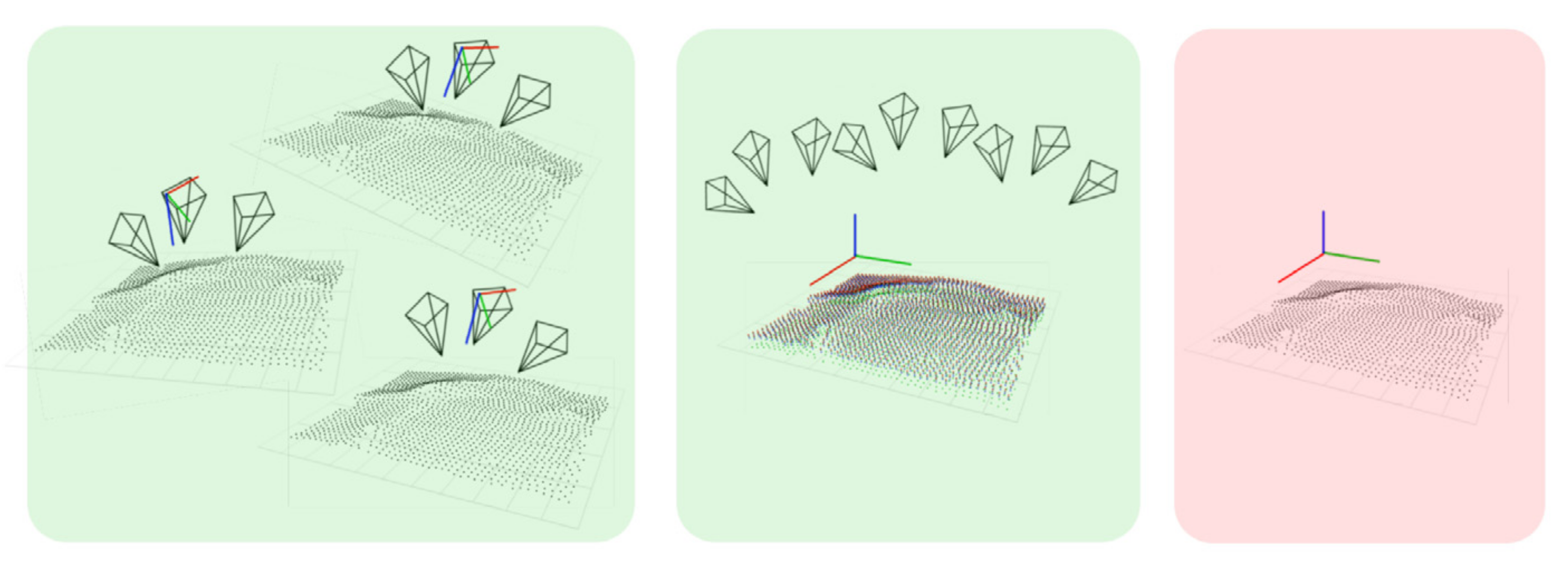
Algorithm
Toy example of the pipeline
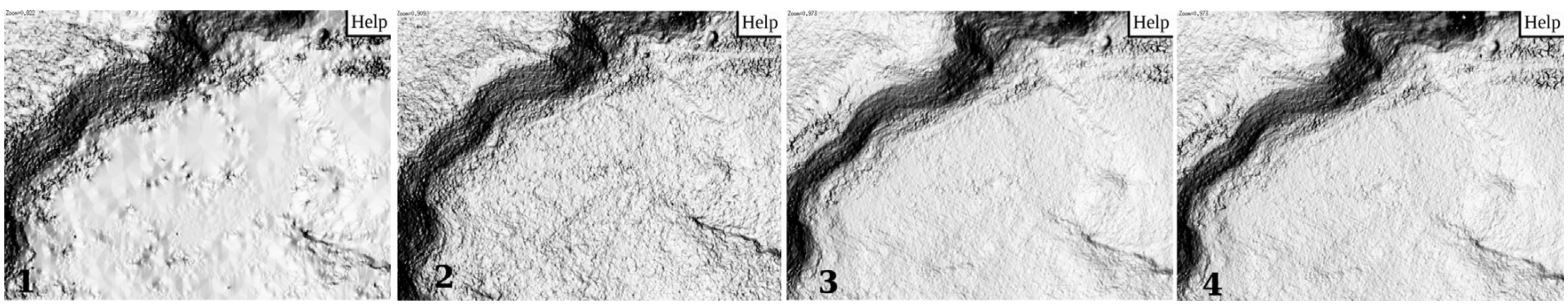
Results
Comparison between different reconstructions.
Publications
- Rupnik, E., Pierrot Deseilligny, M., Delorme, A. 3D reconstruction from multi-view VHR-satellite images in MicMac. ISPRS Journal of Photogrammetry and Remote Sensing, 139, pp. 201-211, 2018.
