Research
Objectives
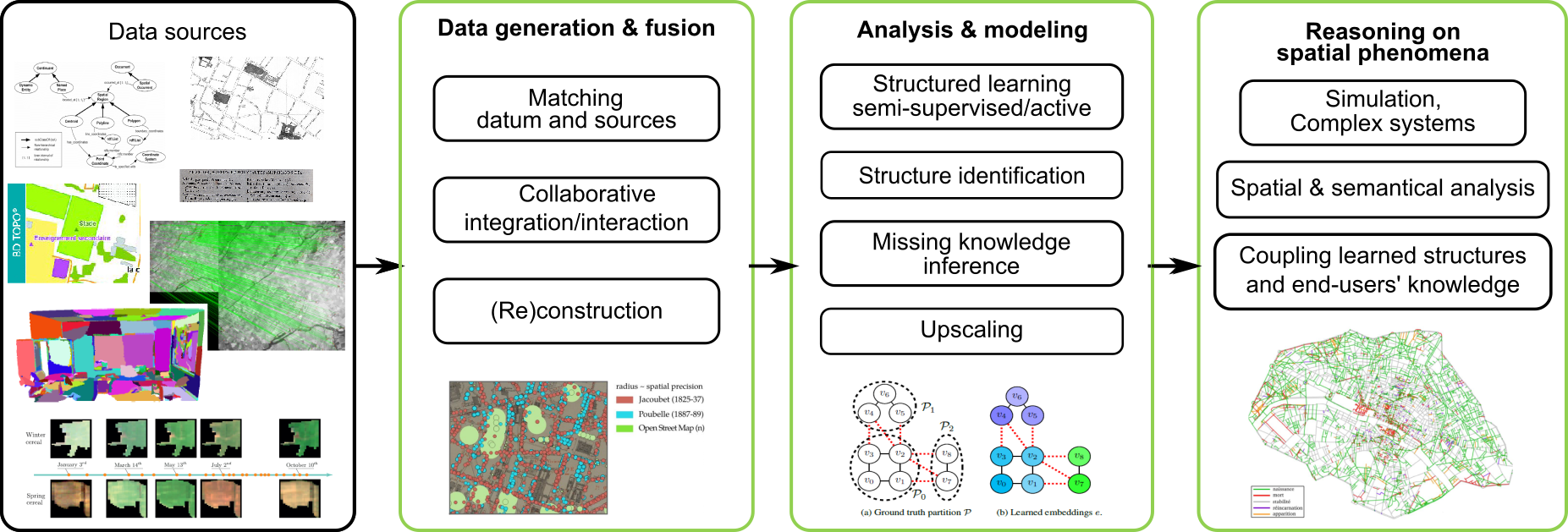
The STRUDEL team of the LaSTIG lab is interested in the data, data structures, algorithms and models required for territory analysis towards a better understanding of its mecanisms and its evolutions. Such analyses are lead in partnership with users and guided by some of their needs: public prescribers, researchers in modeling, geography, social sciences and private companies. This project covers questions related to:
-
the integration of heterogeneous, multi-sources and multi-dimensional data,
-
the organisation of data (concepts, analysis levels, identification of relevant structures/objects/elements, imperfection sources, etc.),
in order to:
- develop models and algorithms taking into account the structure (spatial, temporal, spectral, modal) of data for a better precision of results, a better integration of relevant objects, of spatial representation or to optimise their computation,
- reason in fine on spatialised phenomena, detect and characterise change, semantics-enable, simulate, etc.
Our research is driven by end users’ needs and requirements in order to jointly build with scientific communities and stakeholders models, structured and semantized data, knowledge on territories and its dynamics, as well as simulation scenarios.
Strategical goals
Our work lies across multiple disciplines and data sources (vector, images, text), built with thematical and operational end users in order to custom and validate our research outputs: such end users may either be researchers from other domains (ecology, climate, history, social sciences), stakeholders or private companies dealing with sustainable development, urban planning, etc.
Our research is natively multi-sources. We benefit either or jointly from authoritative sources or collaborative inputs. We try to foster information extraction from complementary and heterogeneous data formats with multiple levels of details (e.g., geospatial sensors with varying spatial, spectral and temporal resolutions).
STRUDEL targets to develop methods and tools able to process the largest number of spatial (building block ⇒ countrywide) and temporal (abrupt changes up to 3 centuries) scales. Au-delà des questions de In addition to modeling challenges, this leads to address upscaling issues in order to digest and process massive amount of data in a fully automatic way with a restricted set of parameters.
We do and promote open and reproductible research.